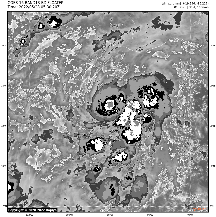
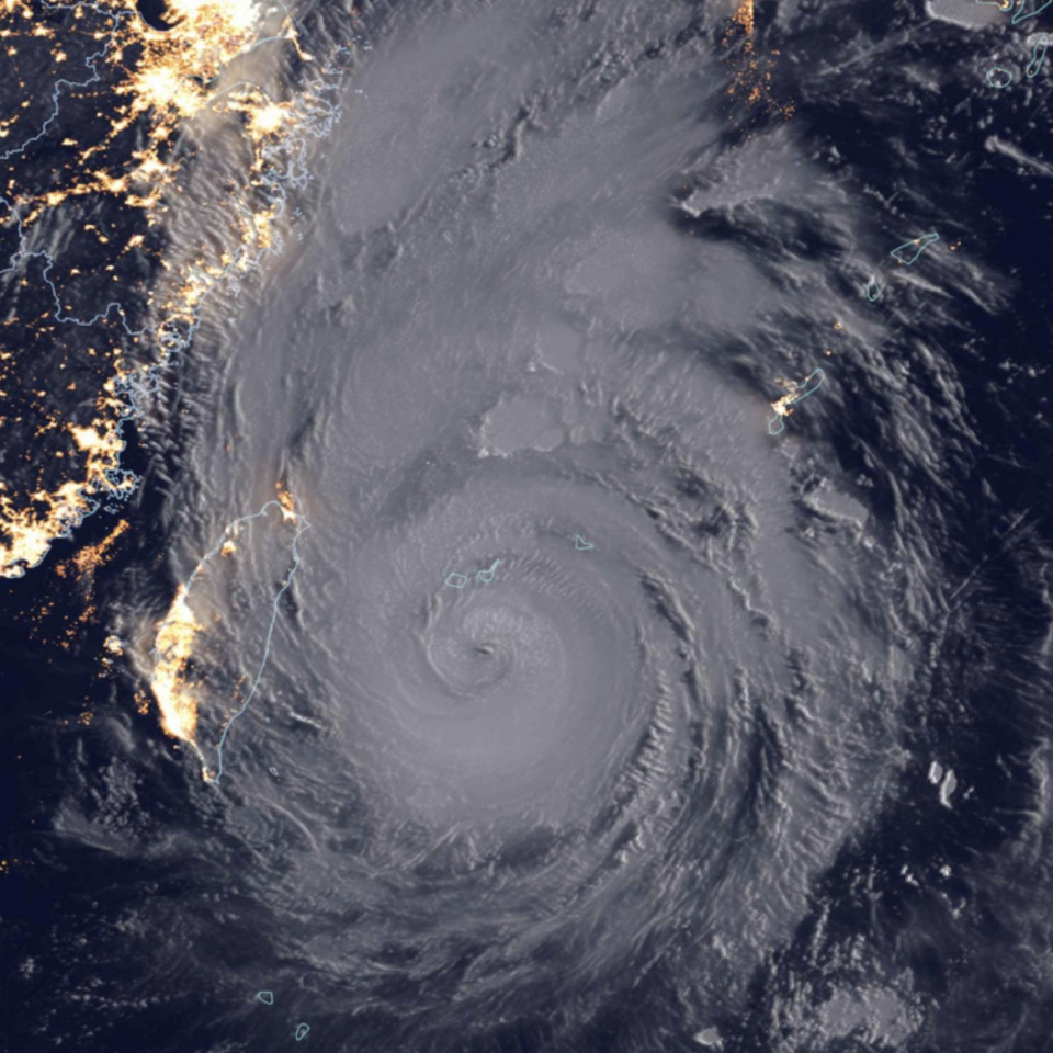
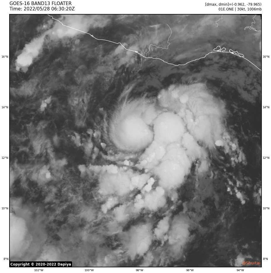
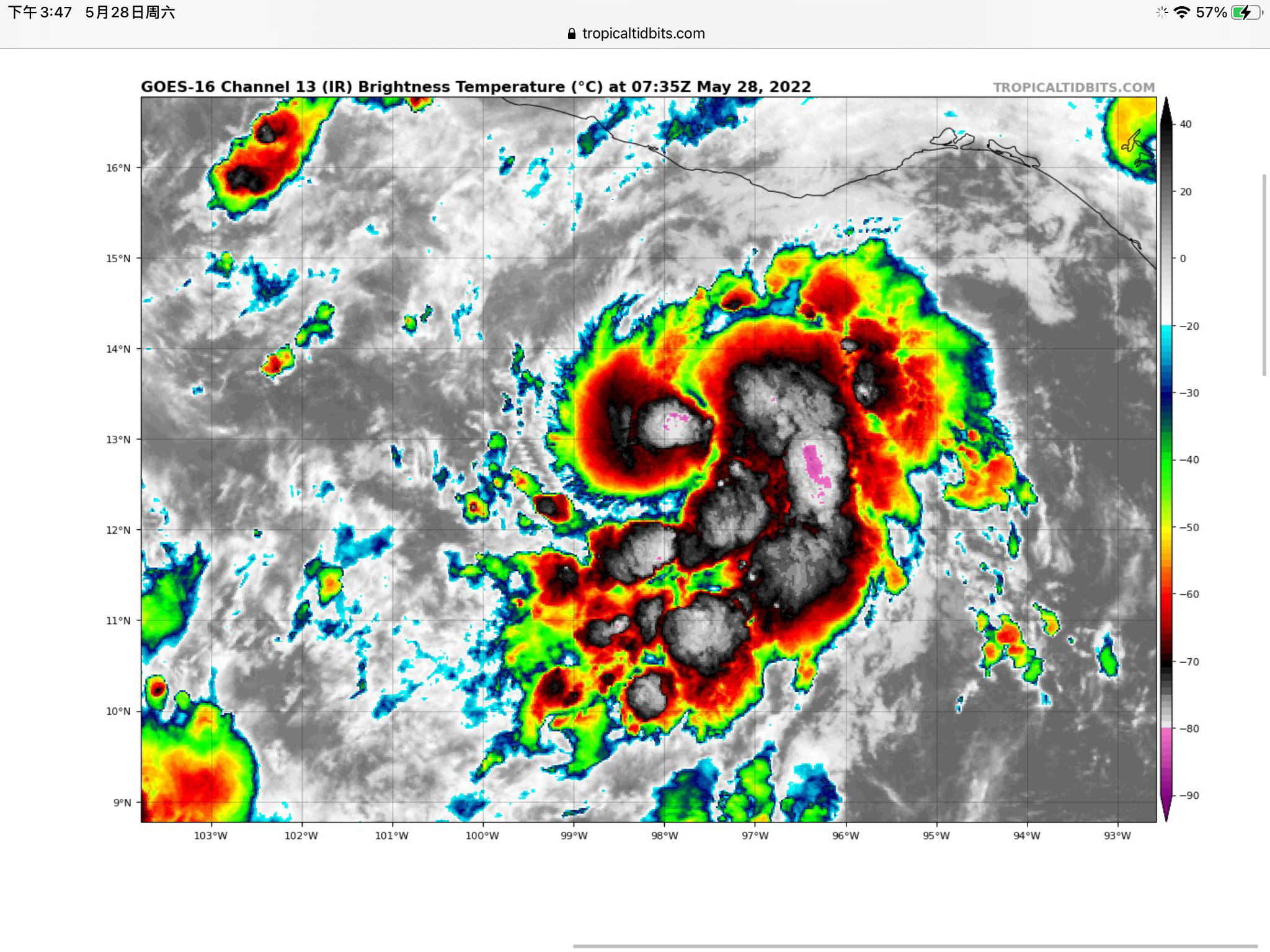
TXPZ21 KNES 280601 TCSENP A. 01E (NONAME) B. 28/0530Z C. 12.8N D. 97.9W E. THREE/GOES-E F. T2.0/2.0 G. IR/EIR/SWIR H. REMARKS...5.5/10 BANDING YIELDS A DT OF 2.5. THE MET IS 3.0 BASED ON A RAPID DEVELOPMENT TREND OVER THE PAST 24 HOURS. THE PT IS 2.5. FT IS BASED ON TRADITIONAL DVORAK CONSTRAINTS, LIMITING THE CHANGE IN T-NUMBER TO 0.5 OVER 6 HOURS. I. ADDL POSITIONS NIL ...COVERDALE
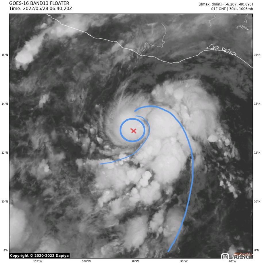
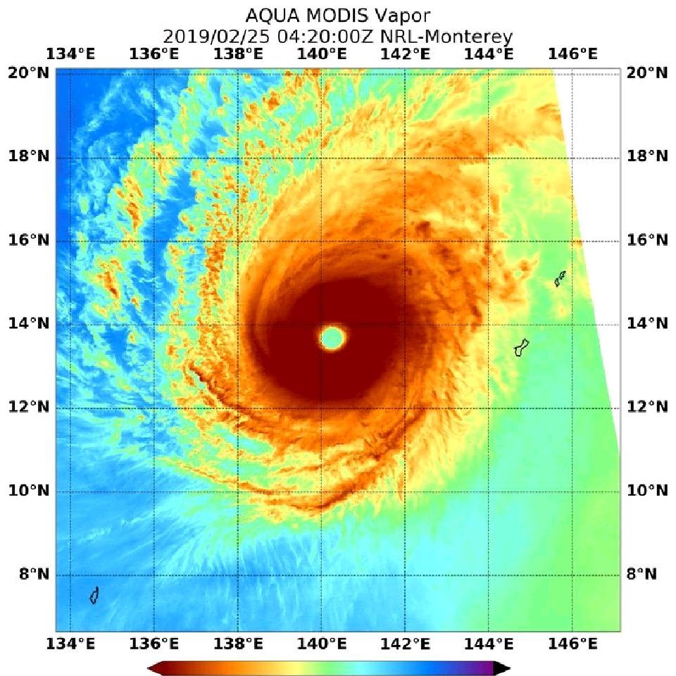
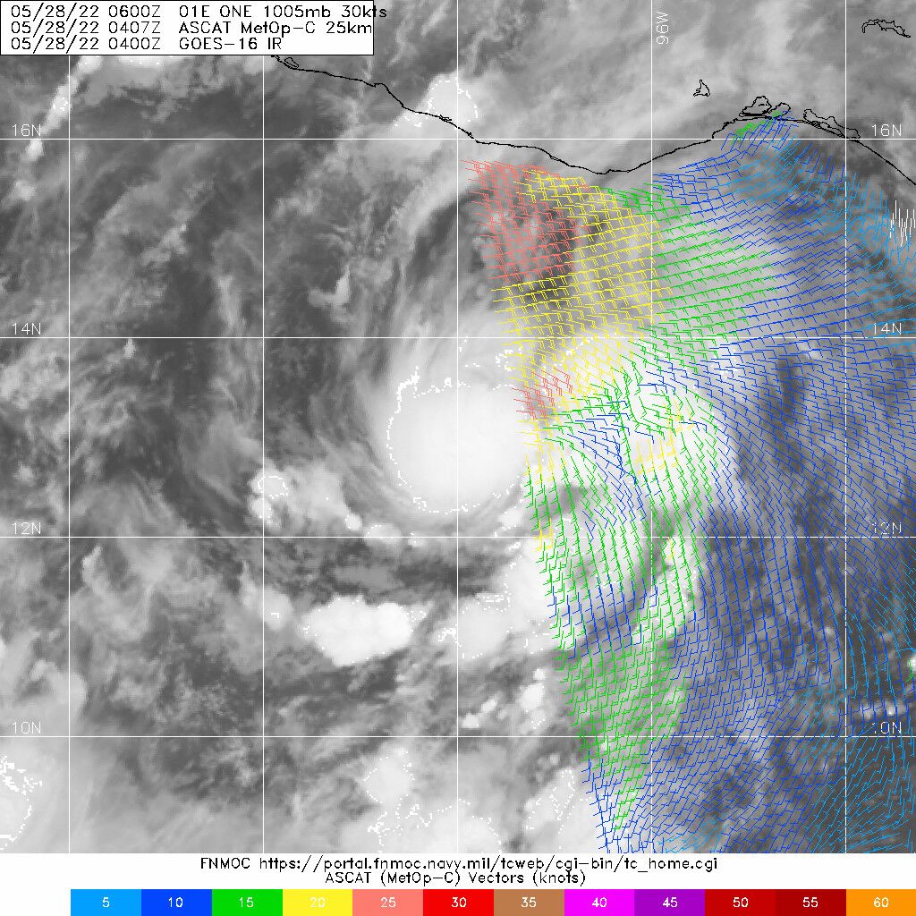
Satellite intensity estimates from SAB and TAFB were 30 and 35 kt at 06Z, and based on the increased organization since that time the initial intensity is increased to 35 kt. Thus, the depression is being upgraded to Tropical Storm Agatha.


![[滑稽]](/static/emoticons/u6ed1u7a3d.png)

![[阴险]](/static/emoticons/u9634u9669.png)
![[汗]](/static/emoticons/u6c57.png) 实测和强度没有关系,要影响陆地的都会实测
实测和强度没有关系,要影响陆地的都会实测


![[真棒]](/static/emoticons/u771fu68d2.png)