【讨论飓风】东太平洋飓风EP012022
台风吧
全部回复
仅看楼主
level 15
EP, 01, 2022053006, , BEST, 0, 146N, 980W, 95, 964, HU,
2022年05月30日 06点05分 259
level 15
全球热带气旋监测公报
预报:柳龙生 签发:董林 2022 年 05 月 30 日 18 时
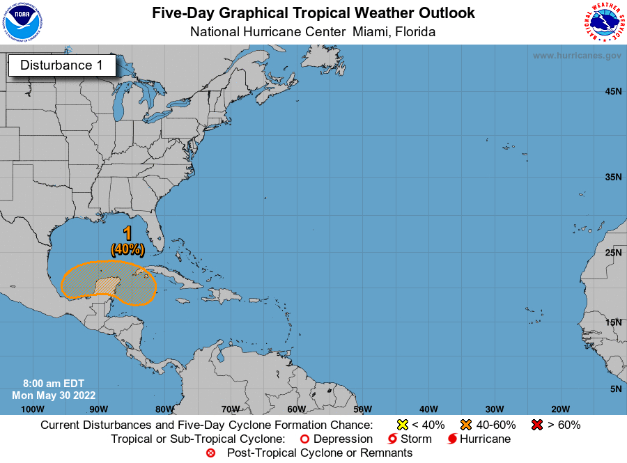
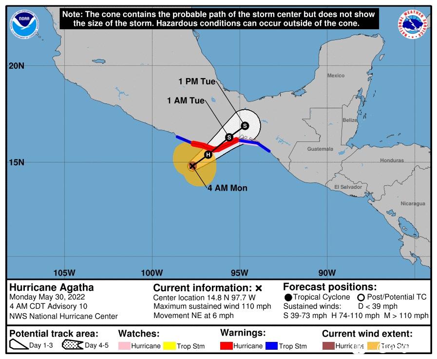
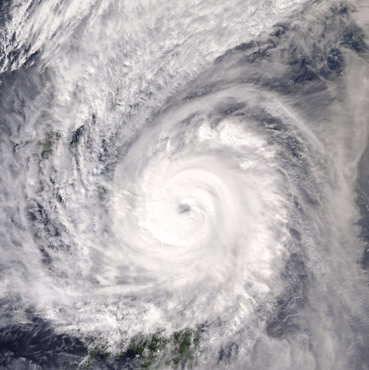
“阿加莎”即将登陆墨西哥
时 间:30日14时(北京时)
海 域:东北太平洋
命 名:“阿加莎”,AGATHA
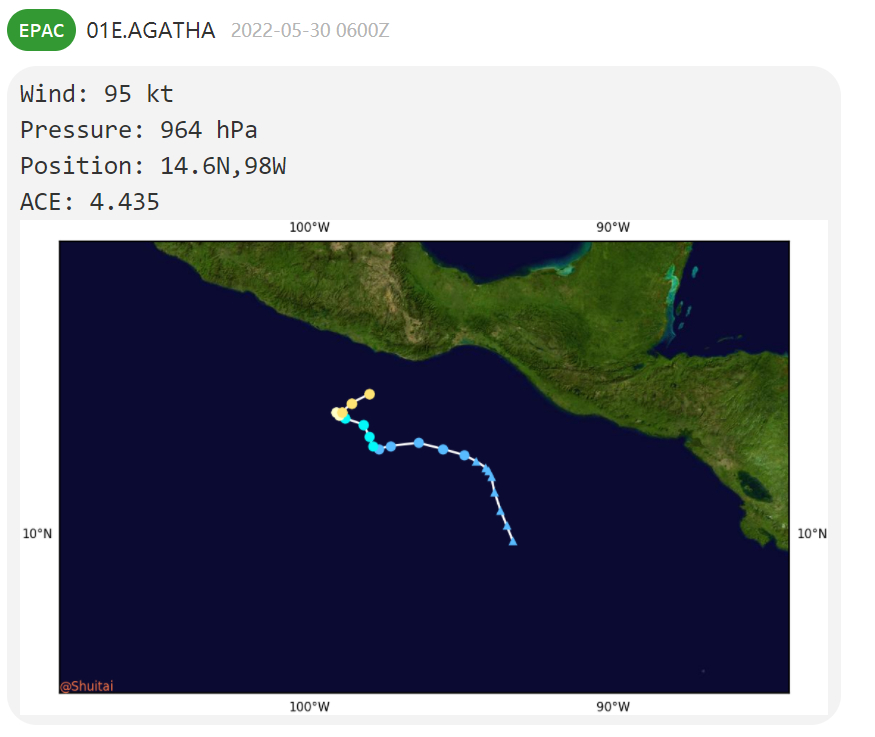
中心位置:北纬14.6度、西经98.0度
强度等级:二级飓风
最大风力:15级(48米/秒,相当于我国的强台风级)
中心气压:964百帕
参考位置:位于距离墨西哥埃斯孔迪多港西南方向约175公里的洋面上
变化过程:过去24小时,“阿加莎”由10级加强到15级
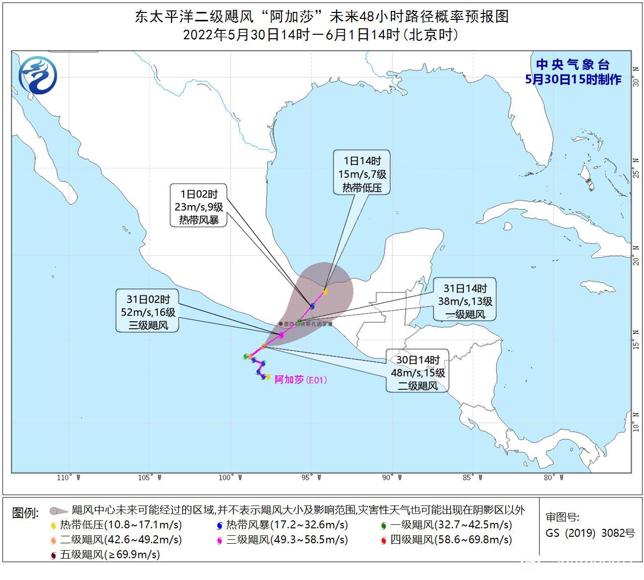
预报结论:“阿加莎”将以每小时10公里左右的速度向西南方向移动,强度缓慢增强,将于今天夜间至明天上午在墨西哥西南部沿海登陆,登陆后逐渐减弱。受 “阿加莎”影响,5月30日20时-6月2日20时,中美洲大部地区有大到暴雨,其中墨西哥南部、危地马拉西南部等地的部分地区有大暴雨,墨西哥南部沿海局地有特大暴雨,沿海局地累积降水量可达400-600毫米。5月30日夜间至31日夜间,墨西哥南部沿海、危地马拉西部沿海将有8~10级大风,阵风11~12级,飓风中心经过的附近海域或地区有11~13级大风,阵风14~15级,局地风力可达14~15级、阵风16~17级。
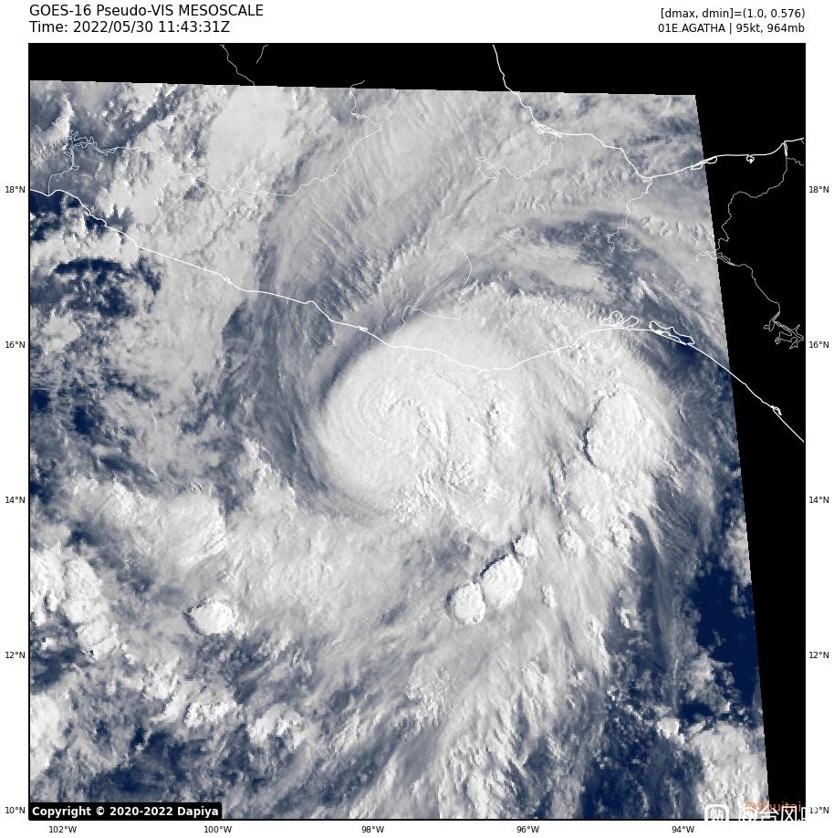
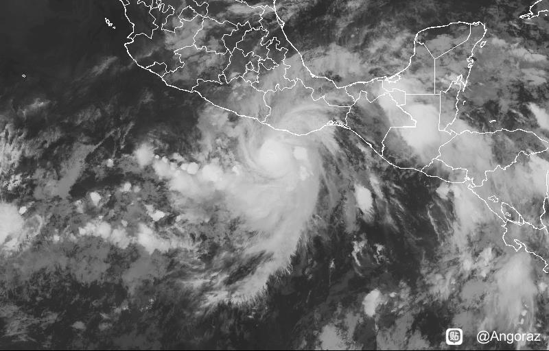
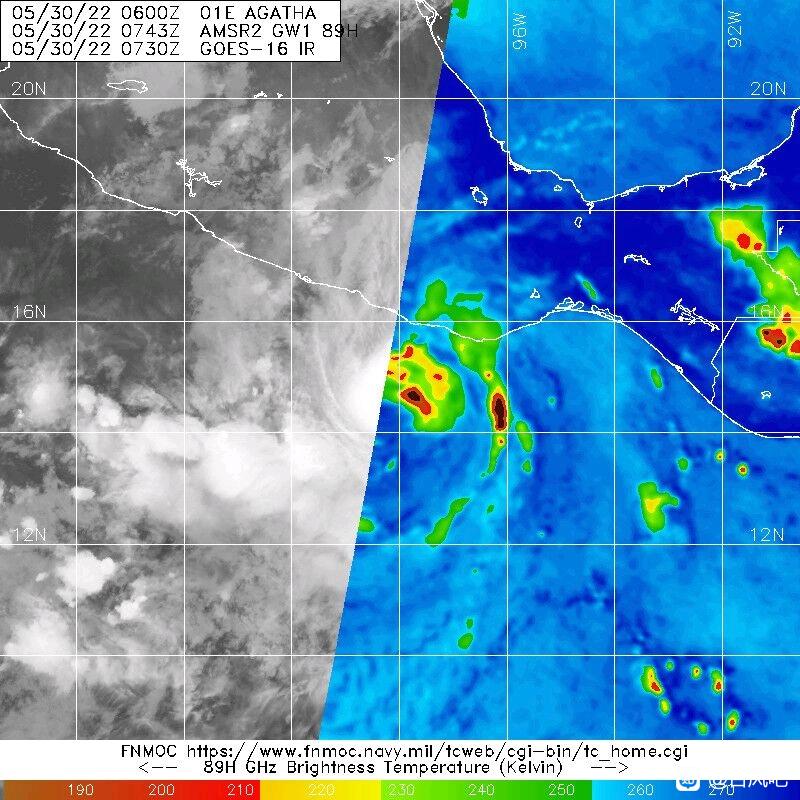
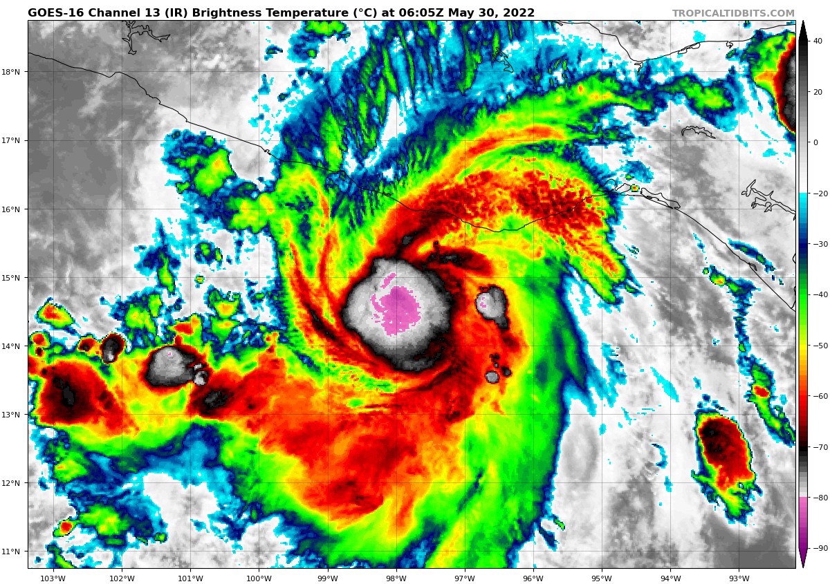
图1 卫星红外监测图像(北京时间2022年05月30日14时30分)
图2 东太平洋二级飓风“阿加莎”未来48小时路径概率预报图
2022年05月30日 08点05分 261
太卷了,就比我早发1分钟[阴险][滑稽]
2022年05月30日 08点05分
level 15
INIT 30/0900Z 14.8N 97.7W 95 KT 110 MPH
12H 30/1800Z 15.4N 96.8W 95 KT 110 MPH
24H 31/0600Z 16.3N 95.6W 60 KT 70 MPH...INLAND
36H 31/1800Z 16.9N 94.7W 35 KT 40 MPH...INLAND
48H 01/0600Z...DISSIPATED
2022年05月30日 08点05分 263
NHC:累了
2022年05月30日 10点05分
level 13
2022年05月30日 10点05分 264
这样也好,至少灾难不会那么重[玫瑰]
2022年05月30日 10点05分
底层彻底崩了
2022年05月30日 11点05分
level 11
2022年05月30日 10点05分 265
level 13
ACE多少
2022年05月30日 10点05分 266
楼下
2022年05月30日 10点05分
level 13
2022年05月30日 10点05分 267
level 8
根据墨西哥国家气象服务中心(SMN)的消息,当地时间5月29日,飓风“阿加莎”(Agatha)正在快速升级加强,目前已经成为2级飓风,并且继续沿着墨西哥西南海岸线前进,预计将于30日下午登陆墨西哥本土,届时将升级为3级飓风,并给墨西哥的6个州带来强风和强降雨等极端天气。
墨西哥瓦哈卡州(Oaxaca)民防部负责人表示,该州已经决定停课,并且提示当地居民做好应对飓风的相关准备
(转自央视新闻)
2022年05月30日 11点05分 268
level 12
这疯切逝几个意思?本想回家看风眼的[怒]
2022年05月30日 11点05分 269
刚才一回家一看形态还以为活了呢[阴险]
2022年05月30日 11点05分
气势还是有的[滑稽]
2022年05月30日 12点05分
level 16
2022年05月30日 11点05分 270
出口北大橙色预警(bushi
2022年05月30日 11点05分
level 8
ABNT20 KNHC 301120
TWOAT
Tropical Weather Outlook
NWS National Hurricane Center Miami FL
800 AM EDT Mon May 30 2022
For the North Atlantic...Caribbean Sea and the Gulf of Mexico:
Near the Yucatan Peninsula:
A large and complex area of low pressure is expected to develop
across Central America, the Yucatan Peninsula, and the southwest
Gulf of Mexico in a few days,
partially related to the remnants of
Hurricane Agatha from the eastern Pacific. Some gradual development
is possible within this system in the far southwest Gulf of Mexico
around mid-week or in the northwest Caribbean by the latter part of
this week as it drifts eastward or northeastward. Regardless of
development, locally heavy rains will be possible across southern
Mexico, the Yucatan Peninsula, Guatemala, and Belize through the
week.
* Formation chance through 48 hours...low...near 0 percent.
* Formation chance through 5 days...medium...40 percent.
$$
Forecaster Brown
2022年05月30日 11点05分 271
level 13
2022年05月30日 11点05分 272
感觉好像又有点样子了
2022年05月30日 12点05分
level 16
TXPZ21 KNES 301201
TCSENP
A. 01E (AGATHA)
B. 30/1130Z
C. 14.9N
D. 97.7W
E. ONE/GOES-E
F. T5.0/5.0
G. IR/EIR/SWIR
H. REMARKS...SYSTEM CHARACTERIZED BY A WHITE EYE SURROUNED BY CMG AND
EMBEDDED IN W FOR A DT=5.0. MET=5.5 PT=5.0. FT IS BASED ON DT.
I. ADDL POSITIONS
NIL
...FISHER
2022年05月30日 12点05分 273
level 16
EP, 01, 2022053012, , BEST, 0, 151N, 974W, 95, 964, HU,
2022年05月30日 12点05分 274
01E AGATHA 220530 1200 15.1N 97.4W EPAC 95 964
2022年05月30日 12点05分
level 13
Agatha残余疑似会在墨西哥湾发展
2022年05月30日 12点05分 275
首页 11 12 13 14 15 16 17 18 19 20 21 尾页