【讨论风暴】北大西洋温带气旋NA11-20211206
台风吧
全部回复
仅看楼主
吧务
level 15
首楼放什么才能不被吞啊
2021年12月06日 15点12分 1
level 13
圆规姐姐
2021年12月06日 15点12分 2
我去,差一点抢到2L
2021年12月06日 15点12分
salute
2021年12月06日 15点12分
6
2021年12月06日 16点12分
6
2021年12月06日 16点12分
吧务
level 15
首楼OPC天气图都能吞,真是绝了。。。
爱尔兰西部系统,OPC已经发布HURCN FORCE,由于未来将移出责任区,因此没有报文
2021年12月06日 15点12分 3
BD最近吞图严重[喷]
2021年12月06日 16点12分
吧务
level 15
Met Office已经命名Barra,同时对多地发布暴雪、大风和强降水黄色警报
A deep area of low-pressure moving in from the Atlantic on Tuesday [7 December, 2021] has been named as Storm Barra by Met Éireann for the level of impacts expected for the Republic of Ireland.
2021年12月06日 15点12分 5
吧务
level 15
OPC同时认为系统将Rapidly intensifying,在24h内降压55hpa,随后强势袭击不列颠群岛。Met Office亦高度关注该系统
Frank Saunders is a Chief Meteorologist at the Met Office. He said: “Strong winds arriving across the west through Tuesday morning, will spread inland and reach eastern areas through the afternoon and early evening. Gusts of 45-50 mph are expected widely, with 60-70 mph in exposed coastal locations. The strongest winds will ease across inland areas into the overnight period.”
Deputy Chief Meteorologist, Brent Walker said: “A band of rain will turn to snow across northern England and Scotland through Tuesday. Two to five cm of snow is expected to accumulate quite widely across the warning area, but locally this could reach ten cm, particularly in parts of the Southern Uplands and Highlands.”
2021年12月06日 16点12分 6
吧务
level 15
18Z 992
2021年12月07日 00点12分 9
level 12
00z 978hpa,迅速降压
2021年12月07日 04点12分 10
level 11
锋后有很强的冷空气
2021年12月07日 04点12分 11
吧务
level 15
爆发性气旋,形态很好
2021年12月07日 07点12分 12
吧务
level 15
2021年12月07日 08点12分 13
吧务
level 15
06Z 962,12h降压30hpa
2021年12月07日 09点12分 14
吧务
level 15
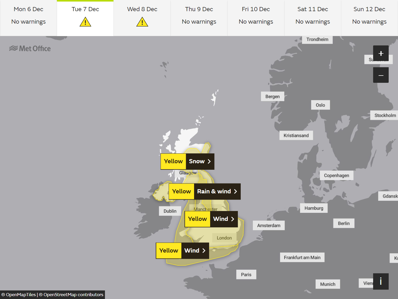
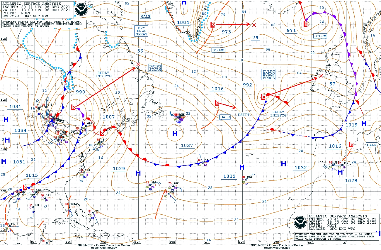
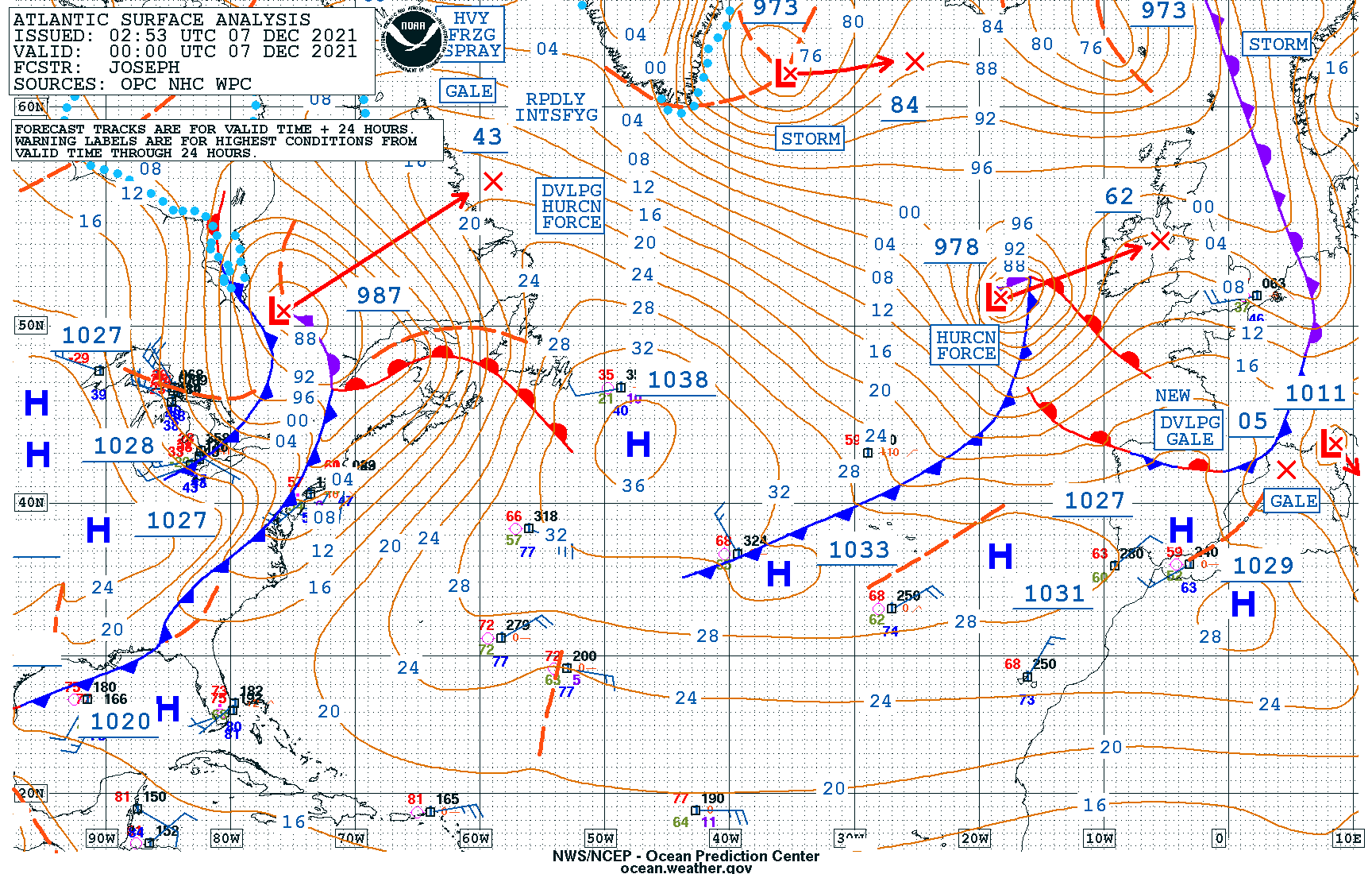
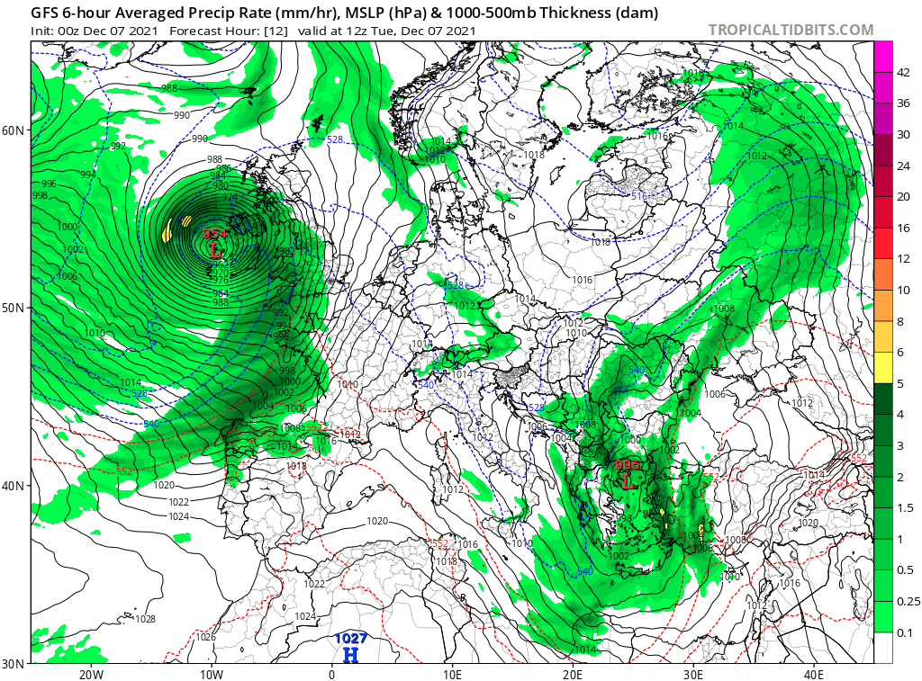
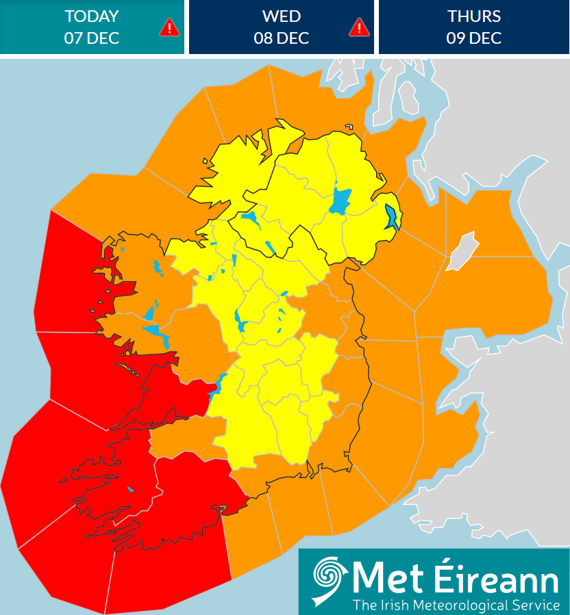
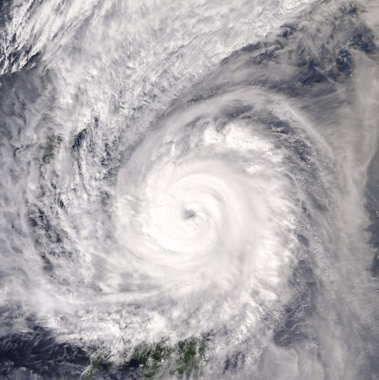
Status Red - Wind warning for Cork, Kerry
Met Éireann Weather Warning
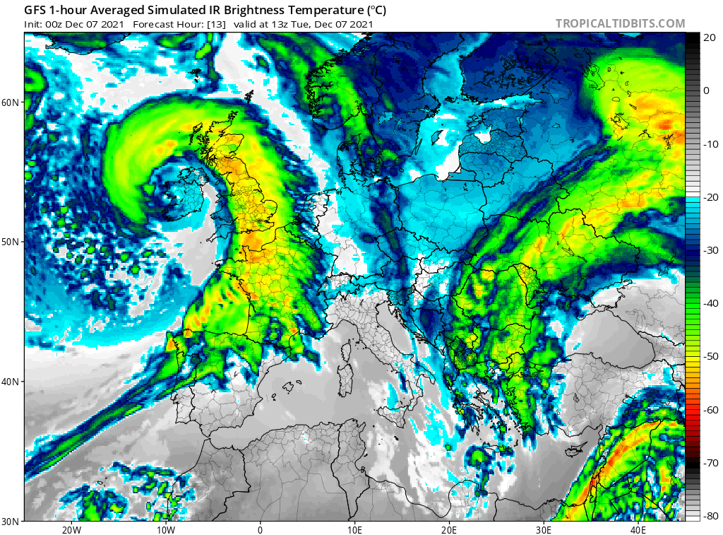
Storm Barra: Southwesterly winds later veering northwesterly will reach mean speeds in excess of 80 km/h with severe or damaging gusts in excess of 130km/h. Due to a combination of high waves, storm surge and high tide, coastal flooding is expected. Disruption to power and travel are likely.
Valid: 06:00 Tuesday 07/12/2021 to 21:00 Tuesday 07/12/2021
Issued: 13:47 Monday 06/12/2021
Status: Red
Storm Barra: Northwesterly winds will reach mean speeds in excess of 80 km/h with severe or damaging gusts in excess of 130km/h. Due to a combination of high waves, storm surge and high tide, coastal flooding is expected. Disruption to power and travel are likely.
Status Red - Wind warning for Clare
Met Éireann Weather Warning
Storm Barra: Northwesterly winds will reach mean speeds in excess of 80 km/h with severe or damaging gusts in excess of 130km/h. Due to a combination of high waves, storm surge and high tide, coastal flooding is expected. Disruption to power and travel are likely.
Valid: 16:00 Tuesday 07/12/2021 to 01:00 Wednesday 08/12/2021
Issued: 16:21 Monday 06/12/2021
2021年12月07日 10点12分 15
吧务
level 15
Mer Eireann 00Z天气图
2021年12月07日 10点12分 16
1 2 尾页