吧务
level 16
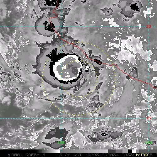
Recent satellite wind data and conventional satellite imagery
indicate that the area of low pressure located near the west-central
coast of Mexico has become better organized and is producing winds
to near tropical storm strength. Some additional development is
possible and this system has the potential to become a short-lived
tropical depression or storm this morning or later today before
it moves inland by Sunday night. Regardless of whether or not this
system becomes a tropical cyclone, heavy rainfall associated with
this disturbance could produce flash flooding and mudslides across
portions of Michoacan, Colima, and Jalisco, especially in areas of
mountainous terrain, during the next couple of days.
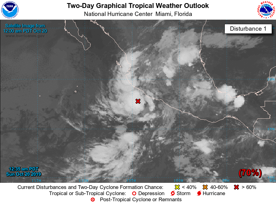
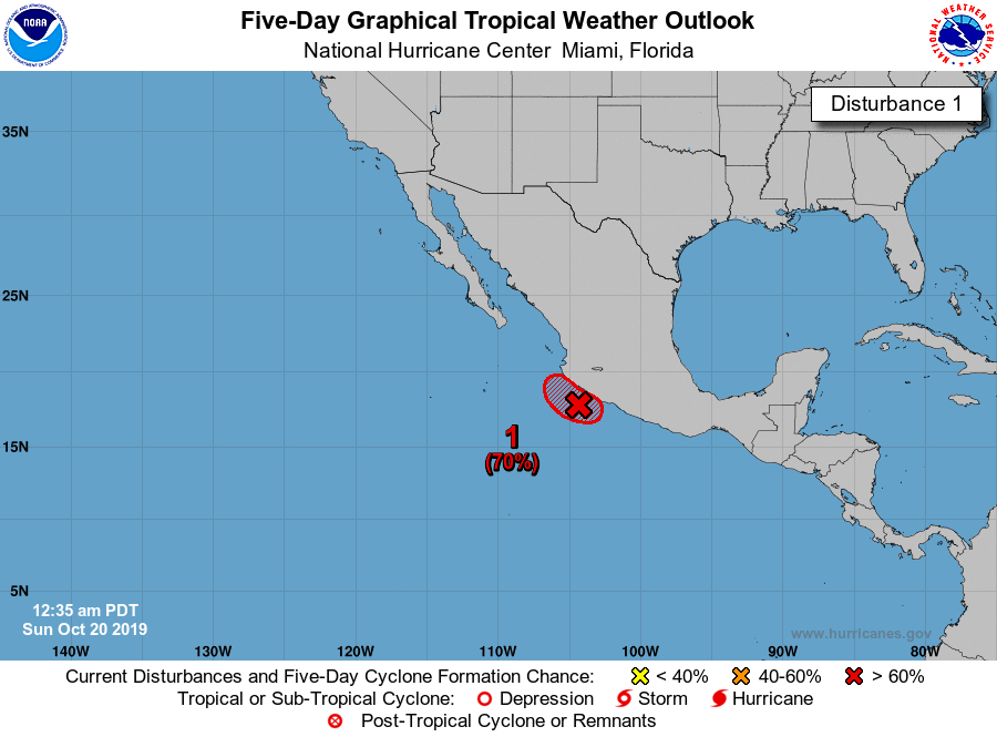
* Formation chance through 48 hours...high...70 percent.
* Formation chance through 5 days...high...70 percent.
2019年10月20日 07点10分
18
indicate that the area of low pressure located near the west-central
coast of Mexico has become better organized and is producing winds
to near tropical storm strength. Some additional development is
possible and this system has the potential to become a short-lived
tropical depression or storm this morning or later today before
it moves inland by Sunday night. Regardless of whether or not this
system becomes a tropical cyclone, heavy rainfall associated with
this disturbance could produce flash flooding and mudslides across
portions of Michoacan, Colima, and Jalisco, especially in areas of
mountainous terrain, during the next couple of days.
* Formation chance through 48 hours...high...70 percent.
* Formation chance through 5 days...high...70 percent.